Watershed Resources
Watershed Introductory Videos
 What is a Watershed?
A shed that holds water? Nope. Everyone in the world lives in a watershed. Watch this short video to learn what a watershed really is.
Why Should You Care About Our Watersheds?
Protecting our watersheds is more important than ever. Fresh water and healthy soils are limited and as our world population grows we all need to do more to preserve and improve the land, air and water.
Nutrien Watershed Contest
Youth around the world are turning their environmental ideas into solutions. The Caring for Our Watersheds program asks the question, “What can you do to improve your watershed?” Answer the question and take action in your community!
Water Nexus Videos
This video series is generously provided by Alberta WaterPortal Society.
Chesapeake Bay Watershed
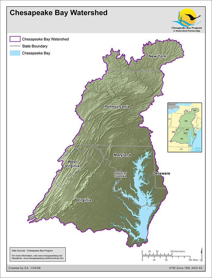
The Chesapeake Bay watershed extends about 500 miles south from the headwaters of Otsego Lake, near Cooperstown, New York to the Atlantic Ocean and Suffolk, Virginia. It extends east from mountain streams near Blacksburg, Virginia to Berlin, Maryland (near Ocean City). It is essentially a giant, sprawling system of rivers that all drain into one shallow tidal basin, the Chesapeake Bay and its tidal tributaries (average depth, only 21 feet).
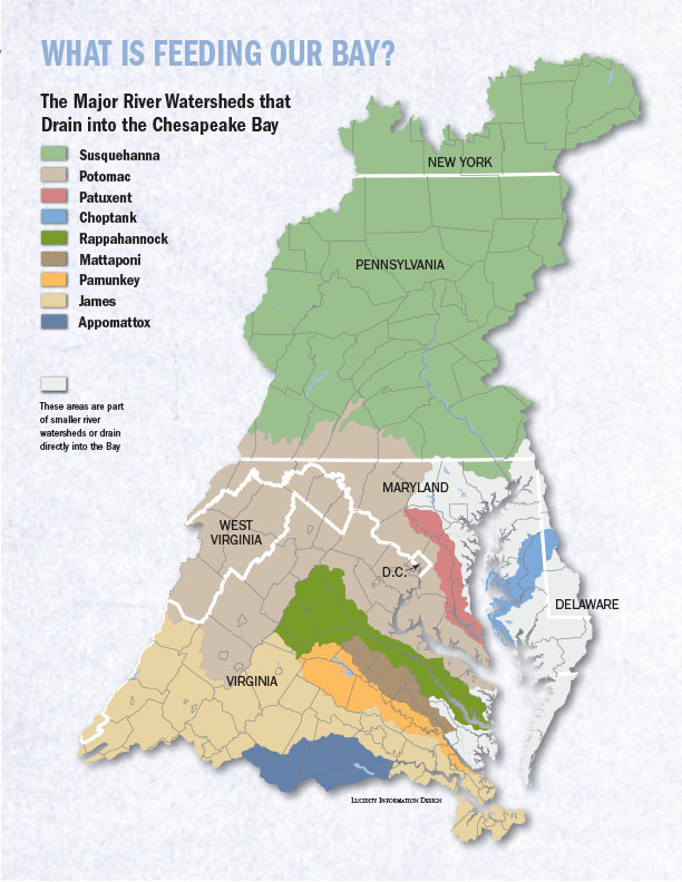
More than 100,000 streams, creeks, and rivers thread through the Chesapeake Bay watershed—the area of land that drains into the Bay. They form an intricate web that connects each of us and our communities to the Bay.
Each of the streams, creeks, and rivers has its own watershed. These small subwatersheds form larger watersheds that flow into larger rivers. In the end, these larger watersheds all drain into the Chesapeake Bay and form the Chesapeake Bay watershed.
Source: Chesapeake Bay Foundation
http://www.cbf.org/about-the-bay/maps/geography/chesapeake-bay-watershed.html
Helpful links:
Chesapeake Bay:
https://www.chesapeakebay.net/discover/watershed
https://www.mdsg.umd.edu/topics/ecosystems-restoration/chesapeake-bay-facts-and-figures
Prince William County Virginia:
http://www.pwcgov.org/government/dept/publicworks/environment/Pages/Watershed-Studies.aspx
http://www.pwcgov.org/government/dept/publicworks/environment/PublishingImages/watershedmap.PNG
http://www.pwconserve.org/issues/watersheds/index.htm
Wicomico River Watershed (Salisbury, MD)
http://delawarewatersheds.org/chesapeake-bay/wicomico-river/